Projects Icon Projects
Gallery

Gallery

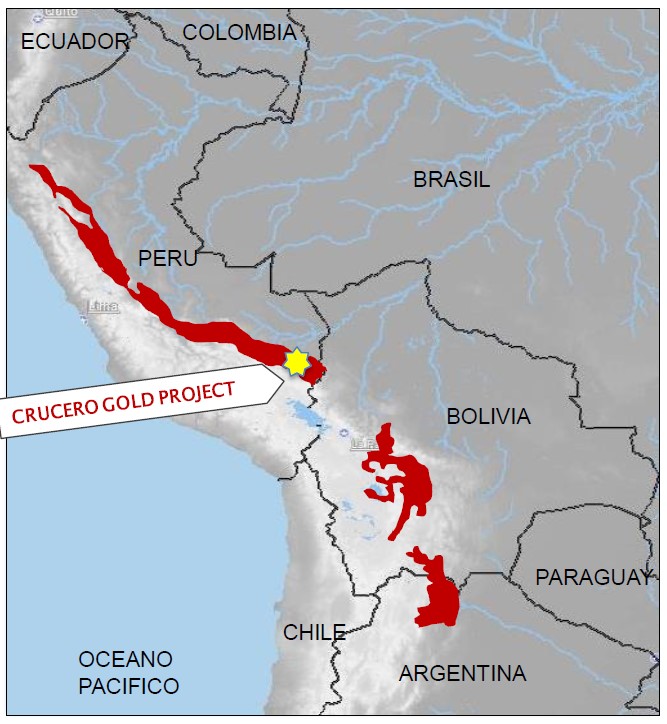
Figure 4: Location of Crucero in relation to the eastern Andean Cordillera and Sierras Pampeanas.

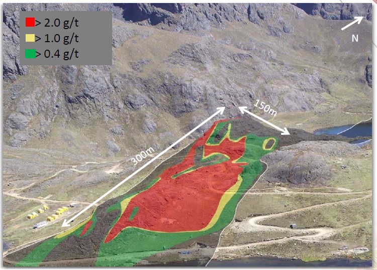
Figure 5: Crucero Project A-1 Zone mineralized envelope outlined on surface photo (0.4 g/t cut-off). The visible outcrop within red outline is >2.0 g/t Au mineralization.

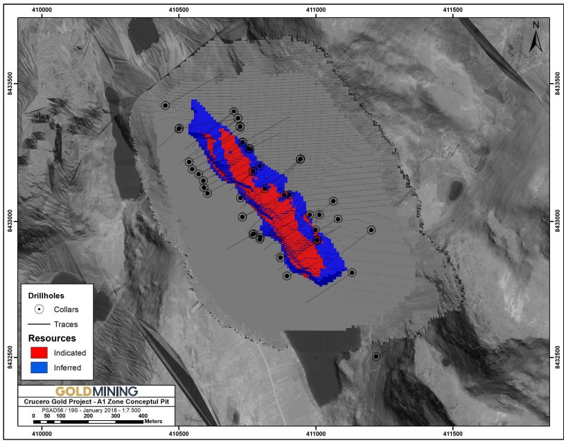
Figure 6: Plan view of Crucero Project A-1 Zone block model showing location of drill holes and outline of constraining pit shell. Source: 2017 Technical Report.

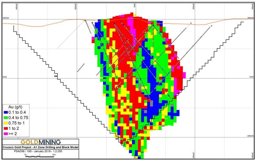
Figure 7: Cross section of the Crucero Project A-1 Zone block model showing location of drill holes and outline of constraining pit shell.  Source: 2017 Technical Report.
Figure 6: Cross section of the Crucero Project A-1 Zone block model showing location of drill holes and outline of constraining pit shell.  Source: 2017 Technical Report.

Subscribe to our GoldMining Investment Newsletter